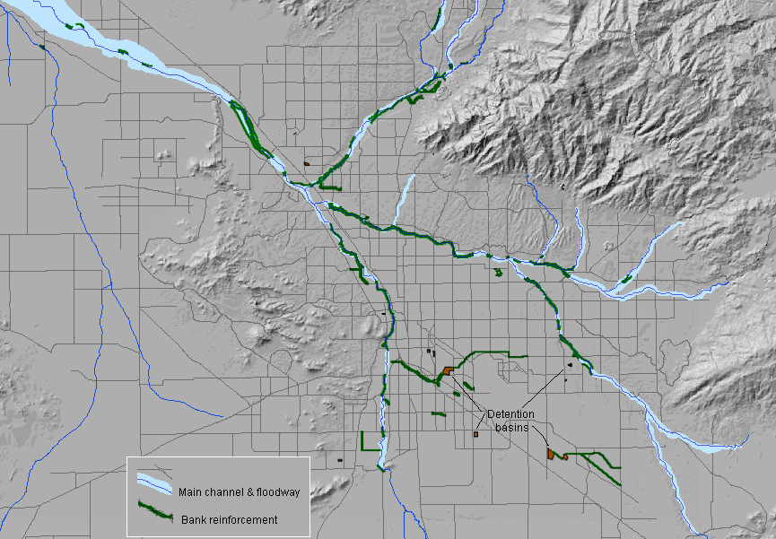
| Figure 4-5 Main floodway and bank reinforcement . 38 |
 |
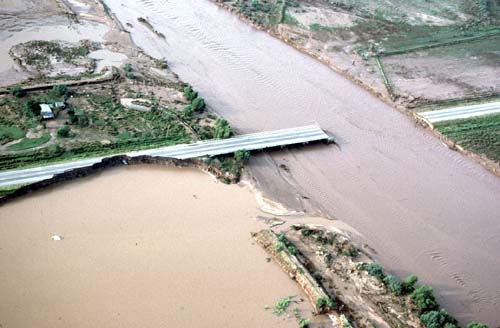
Figure 4-6 Floods damage the Ina Road Bridge.
Photo: Peter
Kresan� 39 |
 |
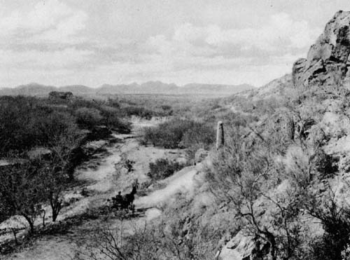
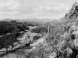
| Figure 4-7 A View Towards the Santa Rita Mountains Around 1900,
Showing the Santa Cruz River and Part of its Watershed. Source:
Tucson Souvenir Portfolio about 1904. 40 |
 |
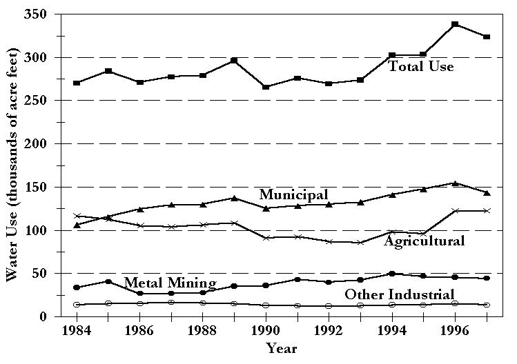
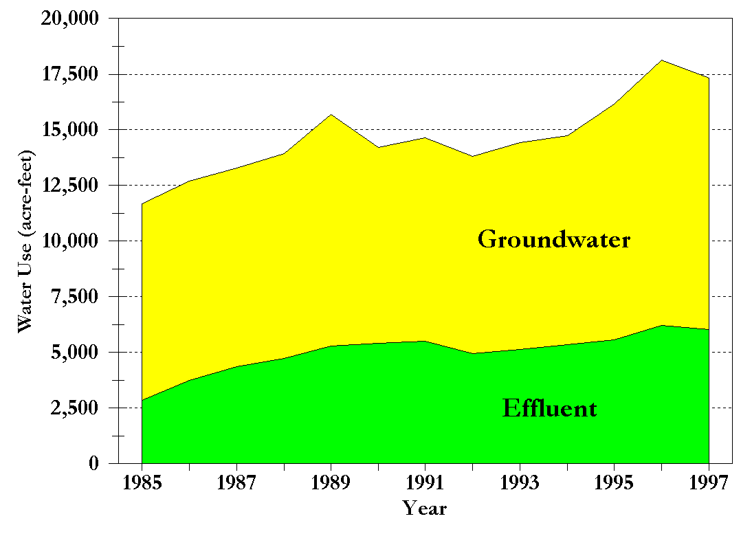
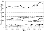
| Figure 5-1 Annual water use by sector, Tucson AMA. 43 |
 |
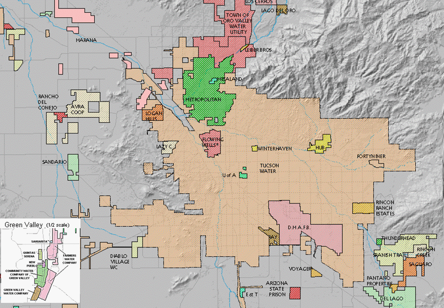
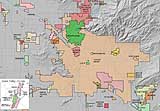
| Figure 5-2 Municipal water provider service areas. 44 |
 |
| Figure 5-3 Water use on Tucson AMA golf courses. 46 |
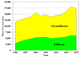 |
Figure 5-4 Treated effluent at a golf course.
Photo: Barbara
Tellman 47 |
 |
| Figure 5-5 Golf courses and reclaimed water systems. 48 |
 |
| Figure 5-6 Typical single family home indoor water use. 49 |
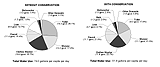 |
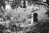
Figure 5-7 Water is saved when a landscape consists of desert,
drought-tolerant vegetation.
Photo: Barbara Tellman 50 |
 |