| Figure 5-8 Fraction of residential lots with pool by year home
built, Pima County 1920-1990. 52 |
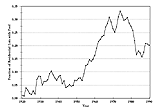 |
Figure 5-9 The Beat the Peak Program tried many approaches to
urge the public to restrict water use during peak hours.
Photo:
Barbara Tellman 54 |
 |
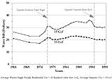
| Figure 5-10 Tucson Water bill for average single family
residential customer, inflation-adjusted 1998 dollars. 55 |
 |
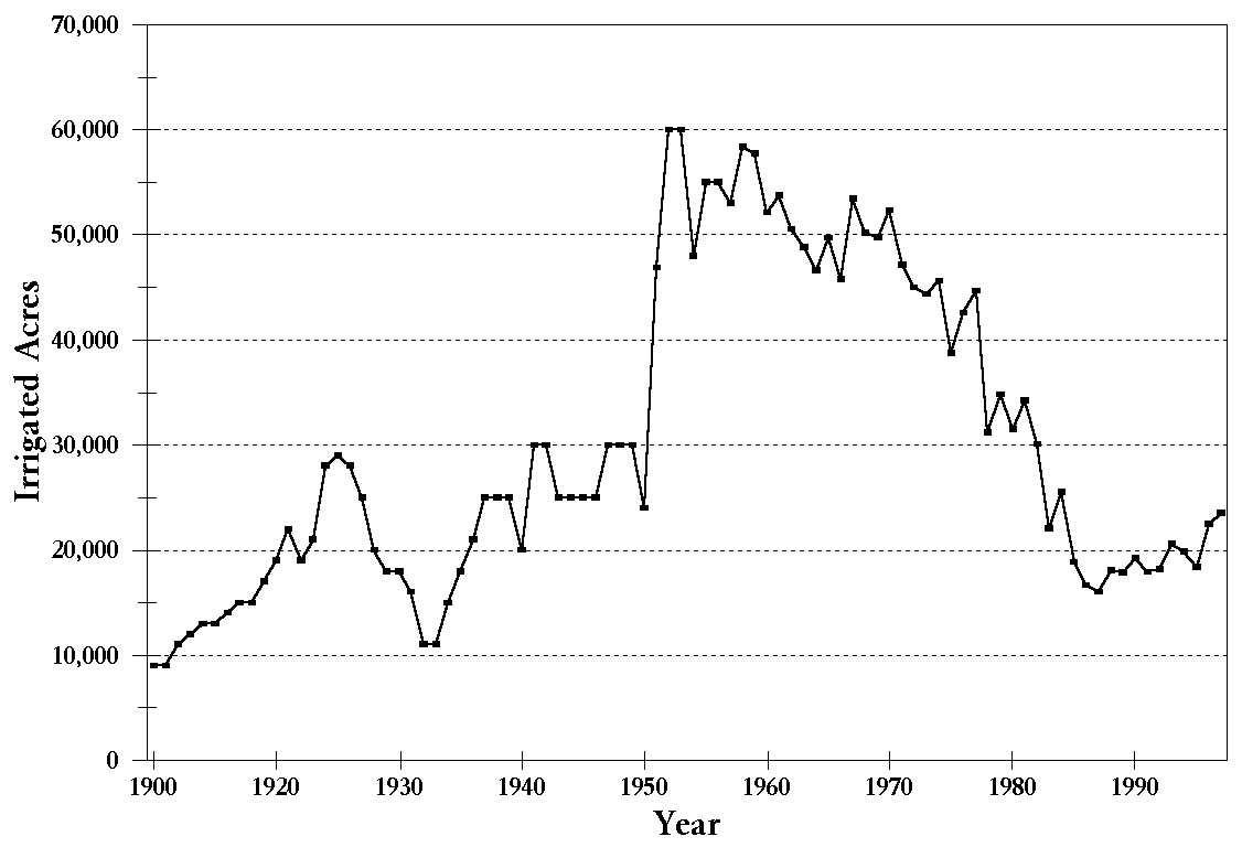
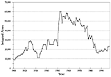
| Figure 5-11 Irrigated acreage in Pima County, 1900-1997. 56 |
 |
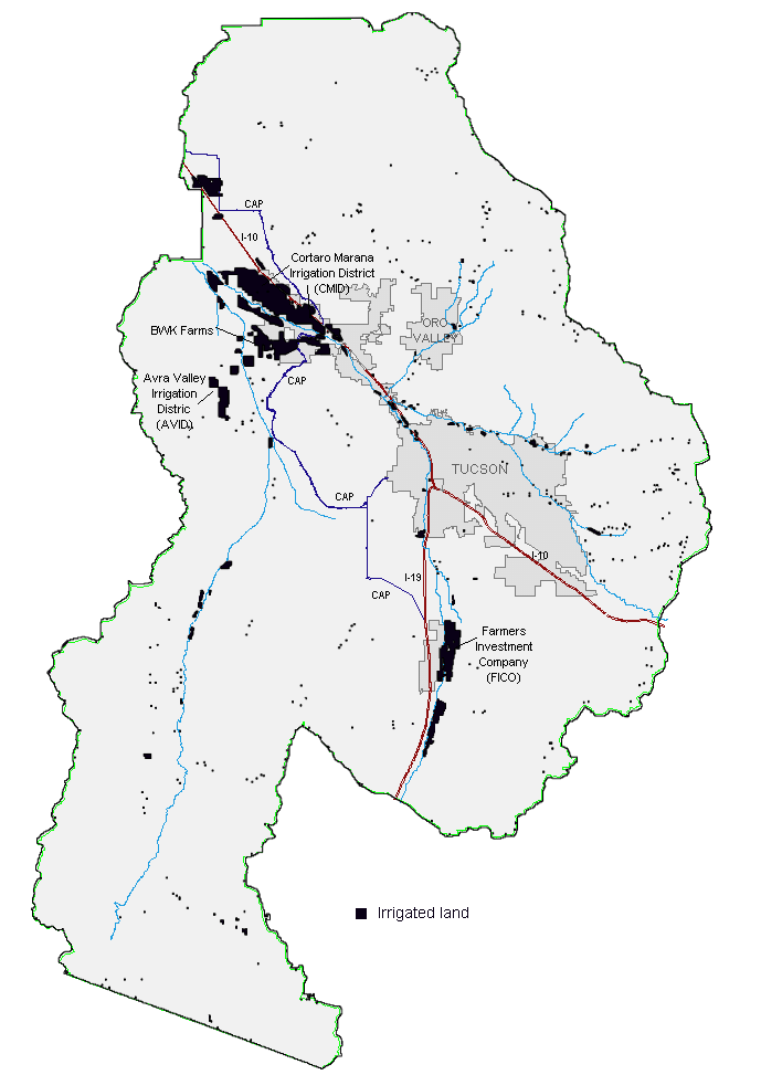
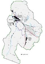
| Figure 5-12 Irrigated acreage in TAMA. 57 |
 |
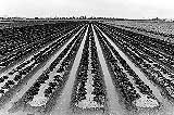
| Figure 5-13 Irrigation made it possible to grow a great variety
of crops in the desert. 58 |
 |
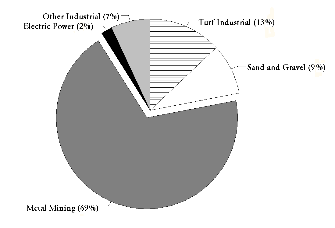
| Figure 5-14 1995 Industrial water use, Tucson AMA. 59 |
 |
Figure 5-15 Typical open pit copper mine.
Photo: Barbara
Tellman. 60 |
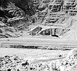 |
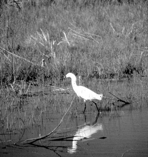
Figure 5-16 Riparian areas are vital to some 85 percent of
Arizona�s wildlife, including migrating birds.
Photo: Barbara
Tellman 61 |
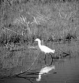 |
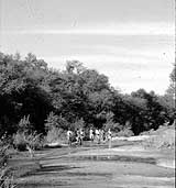
Figure 5-17 Hikers enjoy a visit to Pima County�s Cienega Creek
Preserve.
Photo: Barbara Tellman 62 |
 |