| Figure 2-2 A well at Fort Lowell in the 1880s. Photo: Arizona
Historical Society/Tucson. 6 |
Not available online. |
| Figure 2-3 The Parker and Watts Water Company office in the late
nineteenth century. Photo: Arizona Historical Society/Tucson. 7 |
Not available online. |
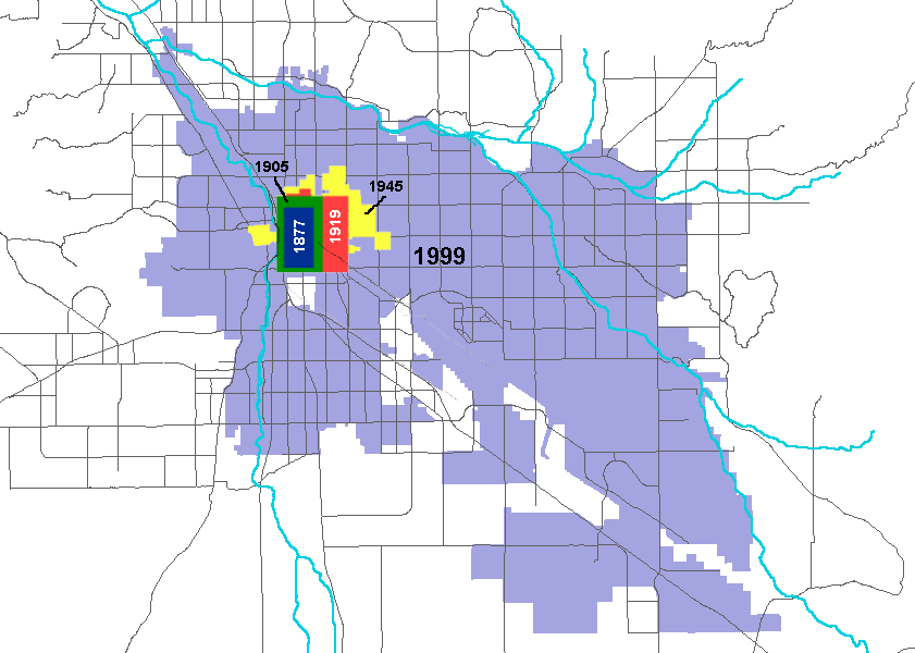
| Figure 2-4 The growth of the City of Tucson 8 |
 |
| Figure 2-5 Population of Pima County, 1850�date. 8 |
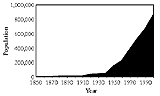 |
Figure 2-6 One of Tucson�s first fire brigades. An adequate
water supply to fight fires has long been an important civic
planning goal. Pressure and volume must be sufficient to fight fires
during times of peak summer demand.
Photo: Arizona Historical
Society/Tucson. 9 |
Not available online. |
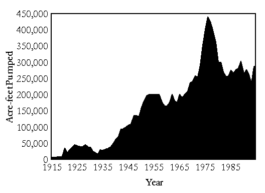
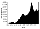
| Figure 2-7 Groundwater Pumping in the Upper Santa Cruz River
Basin from Headwaters to Pinal County. 10 |
 |
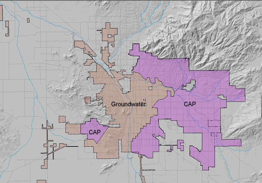
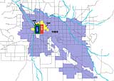
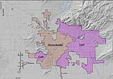
| Figure 2-8 1992-93 CAP delivery areas 11 |
 |
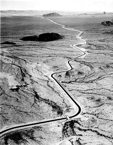
| Figure 2-9 Aerial view of the Central Arizona Project canal.
Photo: Central Arizona Water Conservation District 12 |
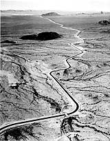 |
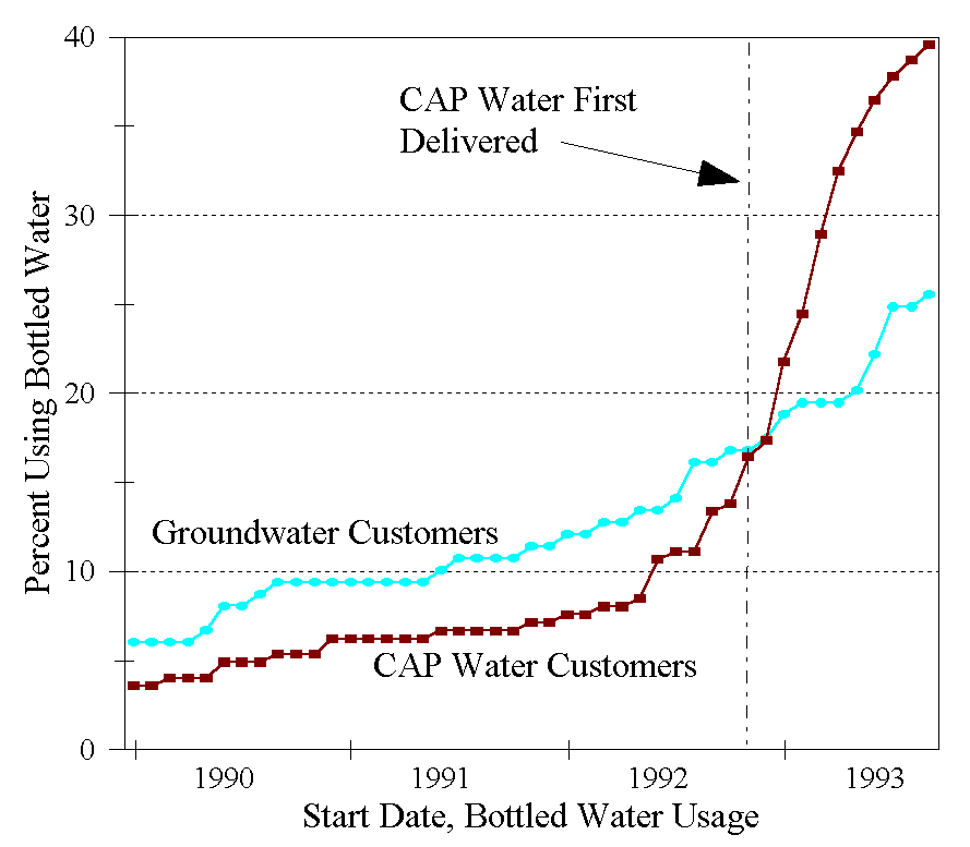
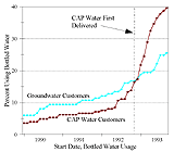
Figure 2-10 Percent bottled water users over time,
CAP vs.
groundwater customers. 13 |
 |
| Figure 2-11 San Xavier Mission. The water table was high enough
to obtain water with a windmill. Photo: Arizona Historical Society
14 |
Not available online. |