|
 ![[continued]](chap1_02_files/cont.gif)
Precipitation in October and November (about 14 percent of annual
rainfall) is quite variable from year to year and is often a result of
severe storms or Pacific hurricanes that �graze� the region. These storms
can produce flooding, often over large areas. These rainfall patterns are
distinctive of the Sonoran Desert and explain the extraordinary vegetation
of the area. The Mohave Desert to the west of Tucson does not receive as
much summer rain, and the Chihuahuan Desert to the east gets less winter
rain than the Sonoran Desert.
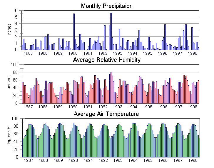
The year-to-year variation of precipitation in the Tucson Basin is
quite substantial. (See Figure 1- 4.) Global phenomena such as El Ni�o and
La Ni�a affect the distribution and magnitude of precipitation. Winter
precipitation in 1992/93 and 1997/98 was as much as 55 percent higher than
the winter average in the Tucson Basin.
 |
| Figure 1-4 Climatological factors
1987-1998.Source: U.S. National Weather
Service |
Evapotranspiration
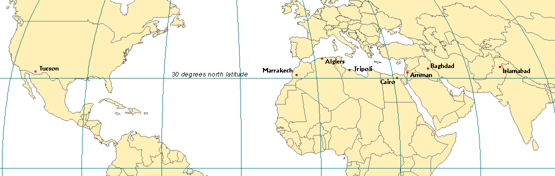
Clear skies and a relatively low latitude make Tucson one of the
warmest areas in the United States. Average summer highs are in the upper
90s with peaks above 110� F. These high temperatures, along with low
relative humidity, contribute to very high water loss through
evapotranspiration. (Evapotranspiration is the combined effect of surface
evaporation and transpiration by plants.) The potential evapotranspiration
rate averages about 77 inches per year which is about 6.5 times greater
than the approximate total annual precipitation in the area. Most of the
precipitation that falls in summer storms evaporates without being used by
plants or people or being recharged into the aquifer.
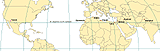 |
| Figure 1-5 Location of cites along
30 degree "arid one" |
|