
 Dr.
Caroline B. Purdy is the Program Manager, for DOE's
Characterization, Monitoring and Sensor Technology Integrated
Program. She was interviewed March 1, 1994.
Dr.
Caroline B. Purdy is the Program Manager, for DOE's
Characterization, Monitoring and Sensor Technology Integrated
Program. She was interviewed March 1, 1994.
Initiatives: Let's begin by giving our readers an overview of your program.
Purdy: We cover all the technology required to characterize a waste site, including the subsurface; and the technology required to characterize waste, stored in drums, barrels, boxes, or whatever. We also have to have the monitoring instrumentation for the treatment processes for that waste yet to be determined, and the instrumentation for monitoring restored sites for thirty years to know that, in fact, it has been cleaned up. The program is large because it includes the information to not only verify the problem, but to assure it has been cleaned up and monitored. Based on Assistant Secretary Grumbly's direction, we've broken the program into five areas.
Initiatives: So these technologies match up with the problem areas he's identified?
The five focus areas that Grumbly has asked us to look at are: 1) high-level waste tanks, 2) mixed waste, 3) containment of existing landfills, 4) cleanup of contaminant plumes, and 5) decommissioning and final deposition (D&D) of the physical structure of DOE's weapons complex. Three areas I described; sensors and instrumentation for contaminant identification and localization, data integration, and geophysical characterization tools; will focus on the landfill problem, the plume problem, and D&D. Nondestructive analysis addresses both mixed waste and high level underground storage tanks.
Initiatives: What are you focusing on right now?
Purdy: Our major emphasis this year is the methodology for characterizing the contaminant plumes in a site. The department is driven by regulatory dates they have to meet to set the RODs (Records of Decision) for cleaning up the sites, and the treatment process for storage has not been decided yet. Until they know exactly how they are going to treat the barrel I don't know how much I have to characterize it. For example, if we decide to characterize to sort, we're going to open the barrel and sort everything out and then treat it by its different waste classifications; then I'm going to need characterization tools that identify each of the constituents of that barrel. However, if we choose to characterize and treat, and the treatment system for example is the plasma arc system, then all I need to know is what is in that barrel that can't be treated in that system, for example, heavy metals, or radiological material. The sets of instrumentation we've got to develop depend on the treatment process.
We started developing technologies and the pay off from that investment was less in individual technologies than in the methodology and approach to site characterization. When we look at any complex problem it requires taking different data sets and looking at it from several points of view. In the case of the subsurface you need the hydrologist who understands the way the water flows in the ground. The geologist understands the sediment and what composition it is. The geophysicist identifies location and extent of different layers. The geochemists describe the chemistry of the water in the subsurface and determine if there is any water flowing between aquifers. The computer people take the data coming in from these different experts, integrate it, and put it in some rational format so that program managers, project managers, and field people, as well as regulators can interpret it and make decisions. The experts use each other's information to verify their own. For example, if the contaminant typically is at highest concentration around 60 or 80 feet, you want to ask the geologist if that is the layer or depth where a clay layer interfaces with a sand layer because you can expect contaminants to get trapped there.
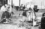
We realized that a combination of experts needs to meet at the site. In the past each expert collected and interpreted data in a vacuum. First came the geophysicist, then six months later a chemist collected data, and then the hydrologists tried to impose what they knew. Data from each expert came into the regulator at separate times. Now we're emphasizing a method that a DOE program manager could use as a plan, adapted for the specific site, and the specific contaminant, that is flexible, incorporates several areas of expertise, and requires a single mobilization. Using this method, we've shown that a site can be characterized 70% to 80% of the way in a four to eight week program on the site, first time out. You have to do a lot of homework before you decide who goes, what technologies will work, what you're measuring for, general strategy, and the general model of that site.
Initiatives: This sounds like a new management philosophy.
Purdy: A new approach
Initiatives: You're not introducing any new machine.
Purdy: Well, let me backup. The decision for a technology to be used or the data from that technology to be used lies in the hands of the regulator at that particular place. It is a local and a regional decision. Because of that, it is very hard to get overall approval of a technology that can be accepted across the country. You can get innovative technologies accepted on a site by site case, or region by region case depending on who you're working with, if you can validate the data, and do a QA/QC that is acceptable for the decision process. That can happen in the field, and has happened in the field, if you back up the new technology with established technology. So, yes, we're introducing innovative technologies but within a framework of established technologies, in a test plan, at a real site, doing real work.
The other major part of expedited site characterization is the dynamics and flexibility to the plant and the site. You can think the water at a site is moving to the northwest in the aquifer and describe its flow rate and think that the contaminant is flowing with the groundwater at a 60 foot depth. Maybe you get to the site and find out there's a fracture there and it's in fact flowing to the southeast. You'll want to turn around and say to the regulators, as of the last three days I am convinced the groundwater is flowing in this direction, so allow me to change my plan. You can move quickly based on the data as it comes in everyday.
Initiatives: Who came up with this idea?
Purdy: My program picked this up by watching an Argonne National Laboratory team in the field. I give credit to this team who started doing this five to seven years ago, and have refined the method. I was in the field with them and realized this is what the Department of Energy needed, so I started promoting the concept and the team and have found some industry teams who also operate in this fashion.
Initiatives: How do you share technical methods and ideas with other agencies and industry?
Purdy: I work closely with some of the key points of contact in the characterization area of all the different federal agencies. DoD, DOE, and EPA have a group that meets to share information. Efforts common to all of us now get coordinated. For example, now that regulators are accepting data as it's taken from cone penetrometers, more and more companies, industries, and federal labs are modifying sensors to fit in the constrained area of a cone penetrometer. The Army at Aberdeen has had a major program in this and we keep in contact about what they're developing and what I'm developing. We're about to take the DOE cone penetrometer truck and put it out in the field. Six months of the year it will be used at EM-40 [DOE's Office of Environmental Restoration] sites or other agency sites. The other six months we'll emphasize the installation and testing of new sensors as industry and federal labs come up with them.
I've also worked with superfund knowing they have major problems characterizing their sites. I looked at their policies and how they approach their problems. I shared my concept of expedited site characterization with them and they are in fact going to start pulling this approach into, not only superfund sites, but also DOE sites.
As for industry, we're spending more of our dollars with industry because we're convinced that it's industry that is going to have to address this problem. Where a DOE site field manager has to characterize a site, most of that work is going to come from an industry partner. Our labs are designing the new technologies but they're transferring them to industry. We're trying to make it so that 50% of our program dollars go to industry. It's not there yet. What we've done to bring industry into this expedited site characterization program is the demonstration that Clyde [Frank] was talking about [see interview premier issue of Initiatives] at York, Nebraska. We invited three sets of people to that demonstration and said this is real work and the regulators have accepted this characterization approach at this particular site. We want you to watch it in action and get a feel for how this process works. We invited industry to see how it's done so they can respond to an RFP [request for proposal] issued by a program manager on a DOE site. We wanted the site managers there from EM-40 who would issue the RFP. Finally, we needed the regulators there from the different regions in EPA to see that this is a concept we were promoting and get their endorsement that this is a better way of characterizing a site.
We're planning to go to a DOE site and use the Argonne team to guide industry through the process, then let them bid on characterizing a particular site once we've told them what the contaminant is and what the general geology is. The Navy sent some people to the demonstration and have taken it up for a base closure. They've already contracted the Argonne team to do the characterization of the first region with the contractor at that site watching and participating daily and then the last four regions are going to be done by the contractor. We're doing it at Pantex because there is a contractor on site that is required to characterize their particular operable units. Argonne will do the work but introduce the approach to the contractors responsible for Pantex so that when Argonne leaves they can take over and use the same methods.
When I give speeches across the country to industry oriented audiences, I speak of this. But I have to give them confidence that EPA is accepting it and that DOE managers will start requesting it. Region 7 has already accepted it, Region 6 accepted it in the Bureau of Land Management sites that Argonne characterized. Region 9 is the area in San Diego where the Navy is introducing it into their program. Region 1 has been working on this kind of concept with a professor from Tufts who has been emphasizing the field training method. By slowly promoting it across the country at regional levels, the way people characterize will change.
Initiatives: How does Expedited Site Characterization affect costs?
Purdy: We emphasize non-intrusive or minimally intrusive characterization technology and that's a key point. Instead of drilling a well as an exploratory tool we avoid that completely and use your well as a verification and monitoring tool. For example, we emphasize geophysical tools like surface sensors that can image subsurface formations, or the cone penetrometer which is a rod that can penetrate the ground and then be pulled out and grouted so there's no hole left behind.
We have a very good example to verify the potential cost savings of expedited site characterization. At one site, they used a remediation system based on standard characterization techniques and found out the contaminant was in a totally different place. The Argonne team recharacterized the site using the expedited site characterization technique. They found that mobilizing the experts to the field for an eight week period cost one tenth as much as drilling the 10 wells required in the first way they characterized the site. With wells you have to continue taking samples as well as maintaining them. It took maybe three months to get the data back from well samples sent off to the lab. When the Argonne team walked off the site they essentially had captured most of the information and it was available in a computer form—at one tenth the cost. That is one example, and the cost cannot always be cut down that much. But, once you use expedited site at one spot, every operable unit after that starts cutting down the cost because you now have a handle on how the subsurface works in that area. When you finish, you emplace a few wells and verify the plume is in fact where you said it was, and keep monitoring it.
We have gone out and said we will cut the dollars used for characterization in half. That is our goal. It's a task of informing people as well as training them. Our biggest problem now is more and more people are calling and asking for it and I don't have trained teams out there that I can deploy. It's a combination of not only informing people but having the people available. Industry is the key factor. We have to have the industry partners out there who can respond to this request.
![]()
![]()
![]()
![]()
![]()