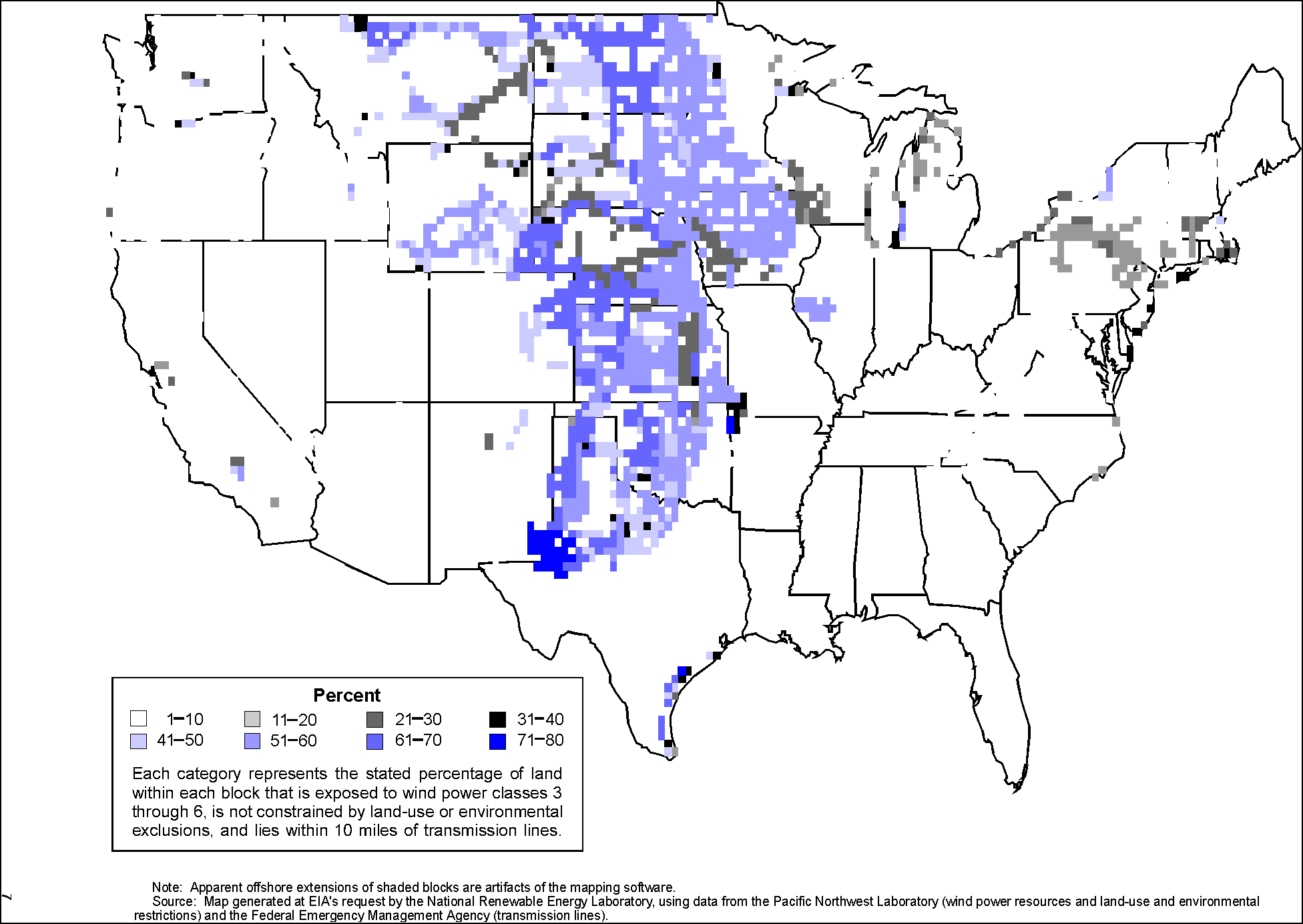
Note: Apparent Offshore extensions of shaded blocks are artifacts of the mapping software.
Source: Map generated at EIA's request by the National Renwable Energy Laboratory, using data from the Pacific Northwest Laboratory (wind power resources and land-use and environmental restrictions) and the Federal Emergency Management Agency (transmission lines).