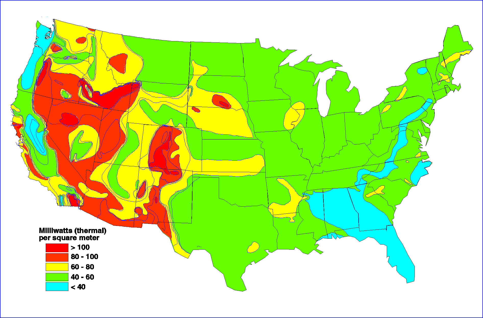
Note: Drawing not to scale. Heat flow contours are patterned in intervals of 20 milliwatts per square meter (mW/m2). Highest temperatures will be associated with areas that have both high heat flow and rock strata with high thermal conductivity. The area along the San Andreas fault has moderate to high heat flow. In fact, The Geysers geothermal system is associated with the tectonic effects of the San Andreas fault system. The Sierra Nevada Mountains are notable as one of the lowest heat flow and crustal temperature areas on earth. A milliwatt (thermal) is a unit of power in the metric system, expressed in terms of energy per second. See "Watt (Thermal)" in the Glossary.
Source: Energy Information Administration, Geothermal Energy in the Western United States and Hawaii: Resources and Projected Electricity Generation Supplies, DOE/EIA-0544 (Wasington, DC, September 1991); Modified after the Geothermal Map of North America, prepared as part of the Geological Society of North America Decade of North America Geology (DNAG), from Blackwell, D.D., and Steel, J.L., Mean Temperature in the Crust of the United States for Hot Dry Rock Resource Evaluation (Southern Methodist University, May 1990), pp. 6-8, updated by D.D. Blackwell.