
|
|
|
To Print Use The pdf File
ILLINOIS URBAN MANUAL
PRACTICE STANDARD
LAND GRADING
(acre)
CODE 865
 (Source: NC Erosion and Sediment Control Planning and Design Manual) |
DEFINITION
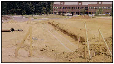
Reshaping the ground surface to planned grades as determined by engineering survey evaluation and layout.
PURPOSE
The purposes of this practice are to provide suitable topography for buildings, facilities, and other land uses, to control surface runoff, and to minimize soil erosion and sedimentation both during and after construction.
CONDITIONS WHERE PRACTICE APPLIES
This practice is applicable where grading to a planned elevation is necessary and practical for the proposed development of a site and for proper operation of sedimentation control practices.
CRITERIA
The grading plan and installation shall be based upon adequate surveys and investigations. The plan is to show the location, slope, cut, fill, and finish elevations of surfaces to be graded. It will also show the auxiliary practices for safe conveyance of runoff water, slope stabilization, soil erosion and sediment control, and stormwater management. These practices may include but are not limited to retaining walls, grass-lined swales, grade stabilization structures, lined ditches, sediment basins, detention ponds, diversions and surface and subsurface drains. The practices may be temporary or permanent, depending upon the need after construction is completed.
The development and establishment of the plan shall incorporate the following, as appropriate:
a. Diversions shall be a minimum bottom width of six feet to provide for maintenance.
b. Diversions shall be designed with cut slope of 6:1 or flatter to the toe of the upper slope and with a minimum of one foot in depth. The gradient to the outlet shall be between 2% and 3%, unless accompanied by appropriate design and computations.
c. The flow length within a diversion shall not exceed 800 feet unless accompanied by an appropriate design and computations. See practice standards DIVERSION 815, DIVERSION DIKE 820 or TEMPORARY DIVERSION 955.
a. The face of the slope is or shall be stabilized and the face of all graded slopes shall be protected from surface runoff until they are stabilized.
b. The face of the slope shall not be subject to any concentrated flows of surface water such as from natural drainageways, graded waterways, downspouts, etc.
c. The face of the slope shall be protected by special erosion control materials, sod, gravel, riprap, or other stabilization method.
| Horizontal Distance (ft.) | ||
|---|---|---|
| Steep Slopes | 2:1 | 20 |
| 3:1 | 35 | |
| 4:1 | 45 | |
| Long Slopes | 15-25% | 50 |
| 10-15% | 80 | |
| 6-10% | 125 | |
| 3-6% | 200 | |
| <3% | 300 | |
CONSIDERATIONS
Fitting a proposed development to the natural configurations of an existing landscape reduces the need for some erosion and sediment control measures. It may also result in a more desirable and less costly development.
Before grading begins, decisions must be made on the steepness of cut-and-fill slopes, how they will be protected from runoff, how they will be stabilized, and how they will be maintained. The grading plan establishes drainage areas, directs drainage patterns, and affects runoff velocities.
The grading plan forms the basis of the erosion and sediment control plan. Key considerations that affect erosion and sedimentation include deciding which slopes are to be graded, when the work will start and stop, the percent and length of finished slopes, where and how excess material will be disposed of, and where fill is needed.
Leaving undisturbed temporary and permanent buffer zones in the grading operation may provide an effective and low-cost erosion control measure that will help reduce runoff velocity and volume and off-site sedimentation. In developing the grading plan, always consider how to take advantage of undisturbed water disposal outlets before storm drains or other constructed outlets are installed.
PLANS AND SPECIFICATIONS
Plans and specifications for land grading shall be in keeping with this standard and shall describe the requirements for applying the practice to achieve its intended purpose. At a minimum include the following items:
All plans shall include the installation, inspection, and maintenance schedules with the responsible party identified.
OPERATION AND MAINTENANCE
Periodically check all graded areas and the supporting erosion and sediment control practices, especially after heavy rainfalls. Promptly remove all sediment from diversions, sediment trapping practices and other water-disposal practices. If washouts or breaks occur, repair them immediately. Prompt maintenance of small, eroded areas before they become significant gullies is an essential part of an effective erosion and sediment control plan.
NRCS IL February 1994